

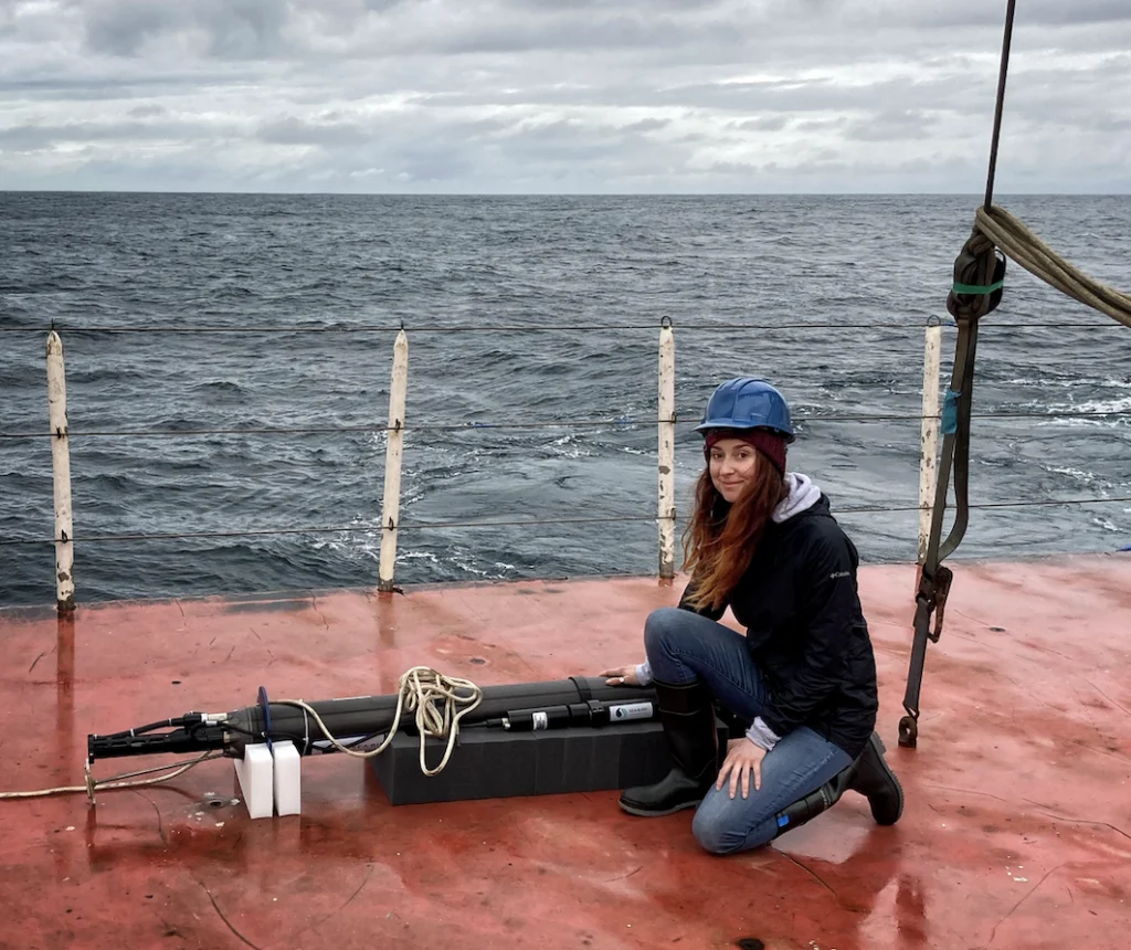
Off the coast of Palmyra Atoll—a remote equatorial outpost in the Pacific Ocean—the sea surface temperature is currently registering approximately one degree Celsius higher than historical averages. While a single degree might seem negligible to a casual observer on a vessel, in the complex theater of global meteorology, it represents a massive energy shift capable of rerouting the jet stream and determining the severity of winter snowpacks in the Rocky Mountains. This localized warming triggers a thermodynamic chain reaction: as the water heats the air above it, surface pressure drops, weakening the trade winds that typically pin warm water near Indonesia. This creates a feedback loop where warm water slides eastward, fundamentally altering where storms form over the open ocean and shifting the atmospheric tracks that eventually deliver precipitation to distant continents.
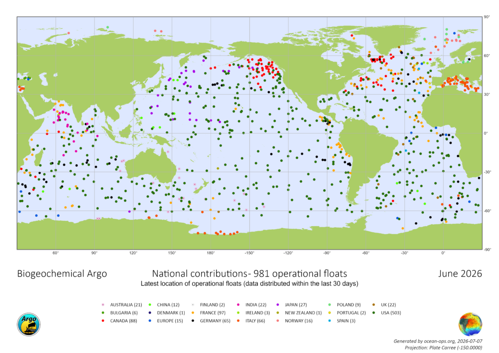
The ability to monitor these subtle but seismic shifts does not rely on manned expeditions or stationary thermometers. Instead, it is the result of the Argo program, a sophisticated global network of approximately 4,000 autonomous robotic floats. Since the early 2000s, these "silent sentinels" have provided real-time profiling of the world’s oceans, diving to depths of over a mile before surfacing every ten days to transmit data via satellite to global receiving stations. However, despite being the backbone of modern meteorology and climate science, the program is facing a critical funding shortfall and administrative hurdles that threaten to dismantle decades of progress.
The Architecture of the Argo Network
The Argo program, named after the ship used by Jason and the Argonauts in Greek mythology, was conceptualized in 1999 to address a massive gap in oceanographic data. Before its inception, measurements of the deep ocean were primarily conducted from research vessels. This traditional method was not only prohibitively expensive—costing tens of thousands of dollars per day—but also geographically limited to specific shipping lanes and seasonal windows.
In contrast, an Argo float operates with remarkable efficiency. Each unit is designed to drift at a "parking depth" of about 1,000 meters. Every ten days, the float descends to 2,000 meters before beginning a slow ascent to the surface, during which its sensors record temperature, salinity, and pressure. Once at the surface, the float connects to the Iridium satellite network, uploads its profile, and then sinks back down to repeat the cycle. The cost of a single profile from an Argo float is estimated at roughly $200, representing a fraction of the cost of ship-based research while providing a continuous, 365-day snapshot of the global ocean.
The network has evolved significantly over the last decade. The standard fleet has been augmented by "Deep Argo" floats, capable of descending nearly four miles (6,000 meters) to monitor the abyssal plains, and "Biogeochemical (BGC) Argo" floats. These advanced units are equipped with sensors to measure oxygen levels, pH, nitrate, and chlorophyll, providing essential data on ocean acidification and the health of marine ecosystems.
A Chronology of the Current Funding Crisis
The stability of the Argo program has historically relied on a decentralized funding model, with the United States contributing over half of the global fleet through agencies like the National Oceanic and Atmospheric Administration (NOAA) and the National Science Foundation (NSF). However, the program’s continuity has been cast into doubt by recent administrative shifts and budget expirations.
- 1999: The Argo program is officially introduced, marking the transition from ship-based sampling to autonomous global monitoring.
- 2000–2020: The fleet grows to 4,000 floats, becoming the primary source of data for over 500 scientific publications annually.
- 2021: A pivotal five-year NSF grant is awarded to launch 500 new BGC-Argo floats, intended to revolutionize our understanding of the ocean’s carbon cycle.
- 2024–2025: As the initial grant nears expiration, program leaders submit a renewal proposal to the NSF.
- Present Day: Over 20 months have passed since the renewal application was filed. Under standard operating procedures, a response is typically received within six months. The current silence from the NSF, coupled with broader budget cuts to climate research under the current administration, has left the program in a state of "funding limbo."
Dr. Shawnee Traylor, a chemical oceanographer and member of the POW Science Alliance, warns that the window for action is closing. "We haven’t been told ‘no’ yet, but we’re running out of time," Traylor noted. "At a certain point, we start losing jobs and decades of critical technical expertise. Right now, our future funding is uncertain."
Scientific and Economic Implications of Data Gaps
The ocean acts as the Earth’s primary thermal regulator, absorbing approximately 90 percent of the excess heat generated by greenhouse gas emissions and roughly 30 percent of anthropogenic CO2. Without the Argo network, scientists would be effectively "blind" to the subsurface processes that drive global warming.
Dr. Traylor emphasizes the scale of this absorption using a stark metaphor: the amount of excess heat the ocean absorbs is equivalent to exploding 12 atomic bombs every second. "We only know those numbers because of Argo," she explains. This heat absorption causes thermal expansion, which accounts for about one-third of global sea-level rise. Sparser data from a depleting float fleet would lead to less accurate models for coastal flooding, potentially leaving millions of residents in low-lying areas with insufficient warning.
Furthermore, the economic impact of losing Argo data would be felt across multiple sectors:
- Agriculture and Winter Tourism: Inaccurate snowpack models would disrupt water management for Western states and impact the multi-billion dollar ski industry.
- Fisheries: BGC-Argo data allows for the tracking of "dead zones" (hypoxic areas) and ocean acidification, which are critical for managing commercial fish stocks.
- Maritime Safety: Mariners rely on Argo-derived data for understanding currents and surface conditions.
- Disaster Preparedness: Modern hurricane intensity forecasts rely heavily on subsurface ocean temperatures. While satellites can see the surface, they cannot see the "heat content" of the water column below, which serves as the fuel for rapid intensification of tropical storms.
Political Landscape and Precedents for Recovery
The current threat to Argo is part of a broader trend of reduced scientific funding. Grants for oceanography have reportedly been slashed by nearly 50 percent over the past year, with climate-specific research facing the heaviest scrutiny. However, there is a precedent for successful intervention through legislative action.
In June 2026, a similar crisis faced the Ocean Observatories Initiative (OOI), another critical marine research network. Despite attempts by the executive branch to dismantle and defund the program, a bipartisan coalition of U.S. Senators—led by Jeff Merkley (D-OR) and Lisa Murkowski (R-AK)—intervened. They successfully passed legislation to protect the OOI, arguing that the system delivers "crucial information about our ocean patterns and weather, reaching and touching all Americans."
A letter signed by 11 U.S. Senators at the time stated that dismantling such networks "jeopardizes decades of prior research" and must be reversed to "prioritize public safety." Advocates for the Argo program are now calling for similar bipartisan support to ensure that the NSF grant is processed and that NOAA’s contribution to the fleet remains robust.
The Cost of Inaction
If the funding gap is not bridged within the next fiscal year, the U.S. will lack the capital to build and deploy new floats to replace those that reach the end of their battery life (typically five years). As floats die out, the "resolution" of the ocean map will degrade.
"Data quality will start degrading, and within a couple of years, that’ll show up downstream as less reliable forecasts for extreme weather events," says Dr. Traylor. The loss of the Argo network would represent a regression in scientific capability, returning the global community to a pre-2000s era where weather predictions were significantly less accurate and climate trends were harder to verify.
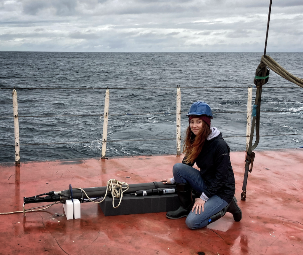
While the floats themselves are small—about the size of a person and weighing roughly 40 kilograms—their collective impact is immense. They provide the foundational data for every weather forecast used by the public. As the climate enters an era of increased volatility, the necessity of maintaining this robotic fleet has shifted from a matter of scientific curiosity to one of national and global security. The coming months will be decisive in determining whether the "Argo" will continue its voyage or be left to drift into obsolescence.
