

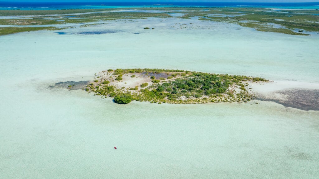
At the surface of the Pacific Ocean near Palmyra Atoll—a remote, uninhabited coral wilderness located roughly 1,000 miles south of Hawaii—the water temperature is currently recorded at approximately one degree Celsius above the historical average. To a casual observer on a passing vessel, this slight deviation might seem negligible. However, in the complex, interconnected machinery of the Earth’s climate, that single degree represents a massive energy shift capable of altering the trajectory of the jet stream and determining whether the mountain ranges of the American West receive a bounty of snow or face a season of drought.
This localized warming triggers a consequential chain reaction. Warm water heats the atmosphere directly above it, lowering surface pressure. Under normal conditions, robust trade winds blow from east to west, sequestering warm water near Indonesia and keeping the central Pacific relatively cool. When these winds falter, a feedback loop initiates: warm water migrates eastward, further weakening the winds and shifting the atmospheric pressure balance. This migration redistributes the locations where major storms originate over the open ocean, ultimately reshaping the storm tracks that impact the Rockies and the Sierras months later.
The ability to monitor these subtle but critical shifts is not the result of manned expeditions or stationary thermometers. Instead, it relies on a sophisticated global network of approximately 4,000 autonomous robotic floats known as the Argo program. Since its inception in the early 2000s, this fleet has provided real-time profiling of the world’s oceans, offering a look at the subsurface conditions that drive global weather. However, despite the program’s proven utility, scientific leaders warn that a looming funding crisis—driven by administrative delays and federal budget cuts—now threatens to dismantle this vital infrastructure.
The Evolution and Mechanics of the Argo Fleet
The Argo program, named after the ship used by Jason and the Argonauts in Greek mythology, was launched in 1999 as a collaborative international effort to provide a "global array for real-time geostrophic oceanography." Before the deployment of these autonomous robots, oceanographic data was primarily collected via research vessels. While effective for localized studies, ship-based research is prohibitively expensive, often costing tens of thousands of dollars per day, and is limited by the physical reach of the fleet.
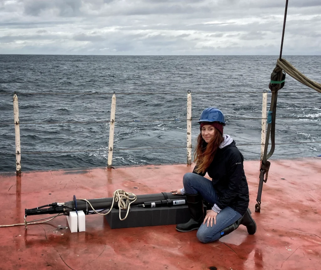
In contrast, the Argo floats offer a continuous, high-resolution snapshot of the global ocean at a fraction of the cost. Each float is programmed to sink to a depth of roughly 1,000 meters, drift for several days, and then descend further to 2,000 meters before beginning a slow ascent to the surface. During this climb, the float’s sensors record temperature, salinity, and pressure. Upon reaching the surface, the device transmits its data via satellite to a global network, making the information freely available to the public within 24 hours.
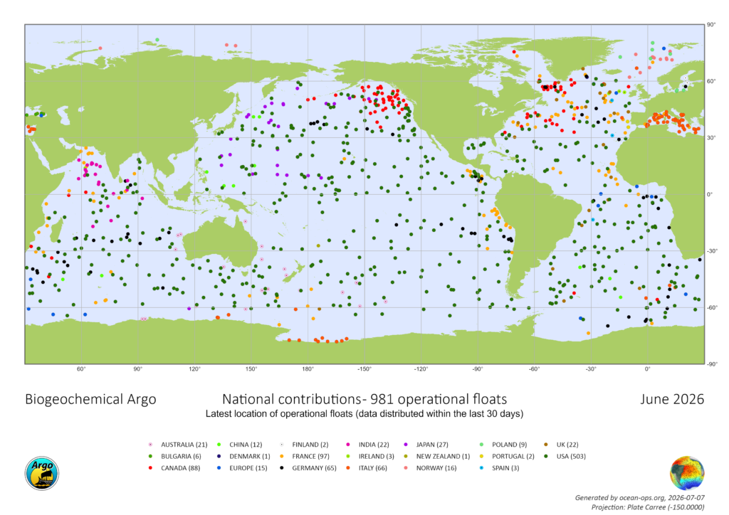
The efficiency of this system is unparalleled in the history of marine science. According to Dr. Shawnee Traylor, a chemical oceanographer and carbon cycle scientist with the POW Science Alliance, each data profile generated by an Argo float costs approximately $200. This low-cost model has allowed the program to expand into more specialized areas, including:
- Biogeochemical (BGC) Argo: Equipped with sensors to measure oxygen levels, pH, nitrate, and chlorophyll, these floats help scientists track ocean acidification and the health of marine ecosystems.
- Deep Argo: Advanced units capable of descending nearly four miles (6,000 meters) to investigate the processes occurring in the deep ocean, where human-driven warming is increasingly being sequestered.
The Role of Ocean Data in Modern Weather Forecasting
The ocean acts as the Earth’s primary thermal regulator, absorbing more than 90 percent of the excess heat generated by greenhouse gas emissions. It also absorbs approximately 30 percent of human-made carbon dioxide. This relationship makes ocean data the bedrock of all modern meteorological modeling.
"The ocean stores the bulk of heat and moisture that drives our weather," says Dr. Traylor. "Satellites capture the surface, but forecasters need that subsurface picture to understand what’s brewing below and when we’ll see it in the weather."
For communities in the interior of the United States, the link between the deep Pacific and local weather is direct. The data provided by Argo is used to calibrate snowpack models, which are essential for water management, agriculture, and the winter sports industry. Furthermore, the data is critical for predicting the intensity of extreme weather events. As oceans warm, they provide more fuel for hurricanes and typhoons. Without subsurface temperature data, meteorologists cannot accurately predict whether a storm will maintain its strength or rapidly intensify as it approaches land.
Argo data is currently cited in over 500 scientific publications annually. Beyond academia, it serves the daily needs of fisheries, commercial mariners, the military, and coastal planners. The data also tracks thermal expansion—the process by which warming water occupies more volume—which accounts for roughly one-third of global sea-level rise.
A Growing Funding Crisis and Administrative Limbo
Despite the program’s success, the U.S. contribution to the Argo fleet—which accounts for over half of the global total—is facing an uncertain future. Funding for the program is decentralized, split between the National Oceanic and Atmospheric Administration (NOAA) and the National Science Foundation (NSF).
A critical five-year NSF grant that facilitated the launch of 500 BGC-Argo floats has expired. Program leaders applied for a renewal grant nearly 20 months ago but have yet to receive a formal response. Typically, the NSF provides feedback or a decision within six months. This silence has left the program in a state of "limbo," unable to secure the necessary capital to build and deploy new floats to replace those that reach the end of their battery life.
The current political climate has exacerbated these challenges. Under the Trump Administration, there has been a concerted effort to reduce spending on climate-related research. Reports indicate that grants for oceanography have been reduced by nearly 50 percent over the past year. For the BGC-Argo initiative, the lack of immediate funding means that no new U.S. floats will be constructed in the upcoming fiscal year.
"We haven’t been told no yet, but we’re running out of time," Dr. Traylor warns. "At a certain point, we start losing jobs and decades of critical technical expertise. Data quality will start degrading, and within a couple of years, that’ll show up downstream as less reliable forecasts for extreme weather events."
Lessons from the Ocean Observatories Initiative (OOI)
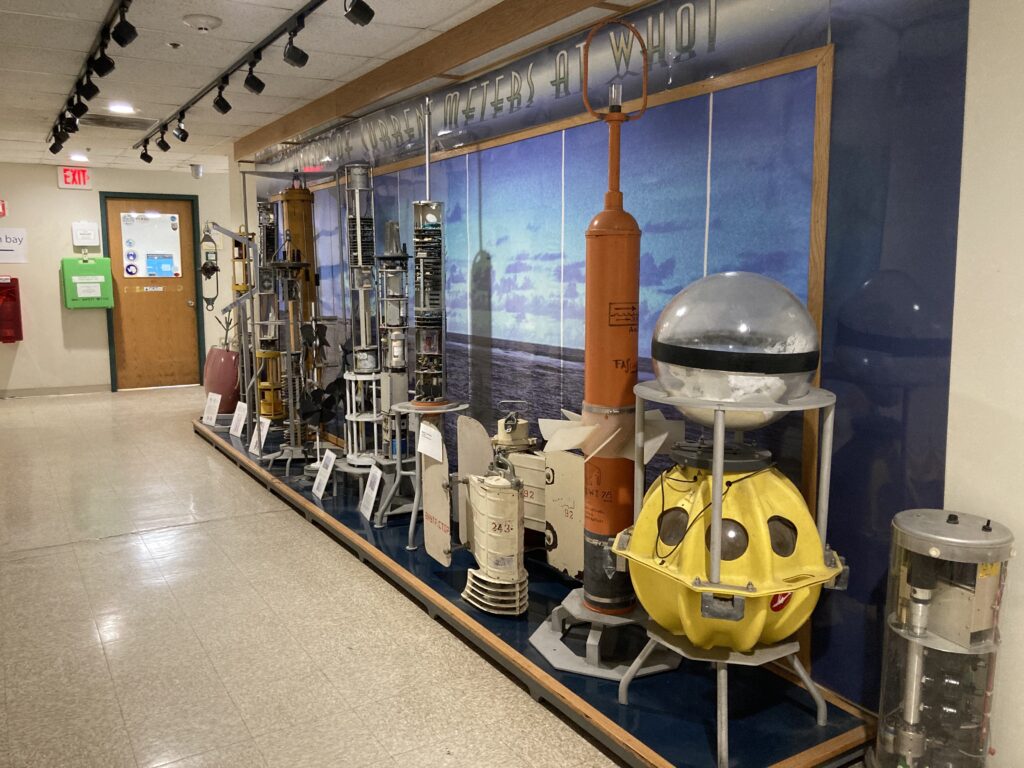
The threat to Argo is part of a broader trend of proposed cuts to oceanographic infrastructure. Recently, the Ocean Observatories Initiative (OOI), another vital research network, faced similar efforts to dismantle its operations. However, the OOI was saved through a bipartisan effort in the U.S. Senate.
In June, Senators Jeff Merkley (D-OR) and Lisa Murkowski (R-AK) spearheaded legislation that successfully blocked the defunding of the OOI. A letter signed by 11 senators to the NSF emphasized that the system delivers "crucial information about our ocean patterns and weather, reaching and touching all Americans." The letter argued that dismantling such networks jeopardizes decades of research and compromises public safety.
Advocates for the Argo program are now looking for a similar "win" in Congress. They argue that the bipartisan support for the OOI demonstrates a recognition of the economic and safety value of ocean data, regardless of political affiliation.
The Long-term Implications of a Sparser Network
If the funding gap is not bridged, the global community faces a future with significantly less "visibility" into the ocean’s behavior. A sparser Argo network would lead to several immediate and long-term consequences:
- Decreased Forecast Accuracy: Without consistent subsurface data, the "lead time" for predicting seasonal weather patterns and major storms will shrink.
- Economic Risk: Industries such as agriculture and insurance rely on long-range climate outlooks. Reduced data accuracy increases the financial risk associated with crop planning and disaster preparedness.
- Scientific Blind Spots: The rate of ocean acidification and oxygen depletion—both tracked by BGC-Argo—could accelerate without scientists being able to quantify the change, potentially leading to the collapse of local fisheries.
- Loss of Global Leadership: As the primary contributor to Argo, a U.S. withdrawal or reduction would weaken the entire international collaboration, potentially prompting other nations to scale back their contributions as well.
The analogy Dr. Traylor uses to describe the scale of ocean warming is stark: the ocean is currently absorbing heat at a rate equivalent to exploding 12 atomic bombs every second. "We only know those numbers because of Argo," she says.
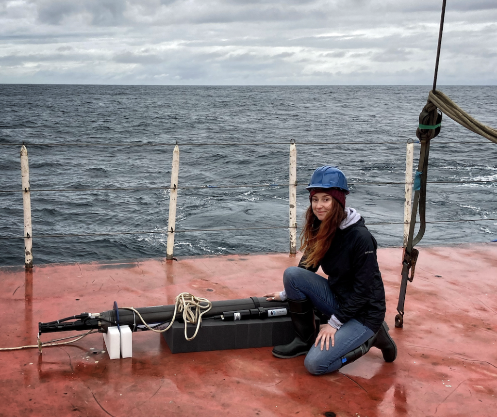
As the program nears a critical juncture, the focus of the scientific community has shifted toward raising public and legislative awareness. While the robots themselves continue to drift through the deep, silently recording the pulse of the planet, the human infrastructure required to maintain them remains on fragile ground. For those whose livelihoods and safety depend on the weather—which, as Dr. Traylor notes, includes "everyone"—the fate of these 4,000 floating robots is a matter of urgent national interest.
