
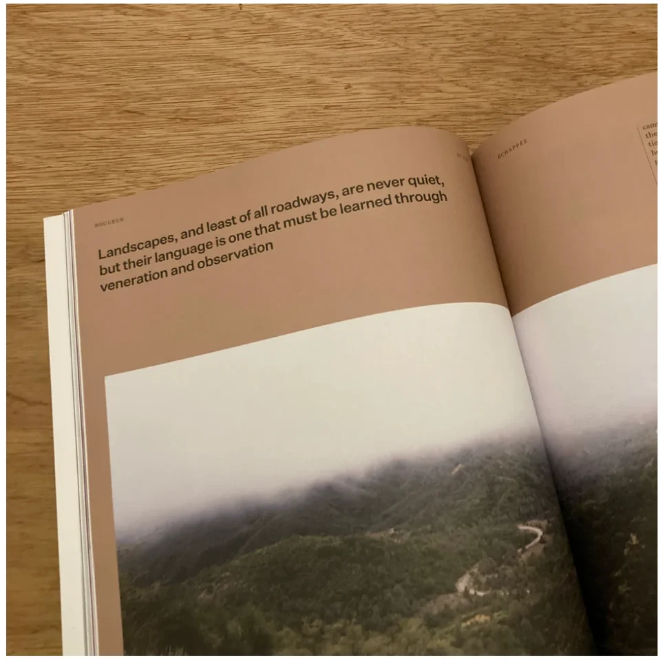
The American landscape is undergoing a silent transformation as thousands of miles of historical and recreational trails vanish annually due to the compounding effects of catastrophic wildfires, systemic neglect, and climate-driven erosion. According to data tracked by environmental researchers and land management advocates, over 5,000 miles of trail are lost each year across the United States. This phenomenon, characterized not only by the physical destruction of paths but also by their removal from official government maps, has sparked a new movement focused on "storytelling and stewardship" to preserve the nation’s cultural and recreational heritage. Central to this effort is the Origins project, a multi-year initiative led by athlete and environmental scientist Dillon Osleger, which seeks to document and restore these "ghost lines" before they are permanently erased from the collective memory.
The crisis of trail erasure is particularly acute in the Western United States, where the increasing frequency and intensity of wildfires have outpaced the capacity of federal agencies to maintain public land infrastructure. When a fire sweeps through a region, it does more than incinerate vegetation; it destroys the hand-cut lines, wooden bridges, and trail markers that define human access to the wilderness. Following these fires, the subsequent rainy seasons often bring debris flows and "atmospheric river" events that carve deep gullies into fire-scarred slopes, effectively obliterating the tread of historical paths.

A Chronology of Trail Development and Decay
To understand the significance of the current loss, it is necessary to view trails as a "palimpsest" of American history—layers of movement written over one another for centuries. The chronology of these paths typically follows a distinct progression of human utility and cultural shift:
- Ancestral and Indigenous Routes: Long before the establishment of the United States, Indigenous nations such as the Chumash in Southern California and the Washoe in the Sierra Nevada established sophisticated networks of trade and ceremonial routes. These paths were designed to follow the natural contours of the land, connecting coastal resources with inland valleys and high-mountain passes.
- The Era of Extraction and Settlement: In the 19th century, settlers, miners, and loggers utilized and expanded these Indigenous routes. During the silver and gold rushes, mule trains laden with ore traversed these lines, which were later used by sheepherders and soldiers.
- The 1930s Infrastructure Boom: The Great Depression saw a massive federal investment in trail infrastructure through the Civilian Conservation Corps (CCC). Thousands of miles of trails were professionally engineered and built to provide access for fire suppression and public recreation, creating the "invisible scaffolding" of the modern outdoor industry.
- The Late 20th-Century Recreation Peak: Following World War II, these trails became the foundation for the burgeoning outdoor recreation sector, serving hikers, mountain bikers, and backcountry enthusiasts.
- The 21st-Century Climate Erasure: In the last two decades, the combination of "mega-fires" and restricted federal budgets has led to a rapid decline. As trails become impassable, the U.S. Forest Service (USFS) and other agencies often opt to remove them from updated maps rather than attempt costly restorations.
Data and the Federal Funding Gap
The scale of this infrastructure crisis is supported by federal auditing. A landmark 2013 report from the Government Accountability Office (GAO) revealed that the U.S. Forest Service was only able to maintain approximately one-quarter of its 158,000 miles of designated trails to agency standards. At the time of the report, the agency faced a maintenance backlog exceeding $314 million.
In the decade since that report, the situation has worsened. A significant portion of the USFS budget has been redirected toward "fire borrowing"—the practice of shifting funds away from recreation and land management to cover the soaring costs of fire suppression. Consequently, trails that are damaged by fire or floods are frequently reclassified as "non-existent" in administrative databases. This "deleting of lines" serves as a bureaucratic solution to a lack of physical resources, but it results in a permanent loss of public access and historical record.
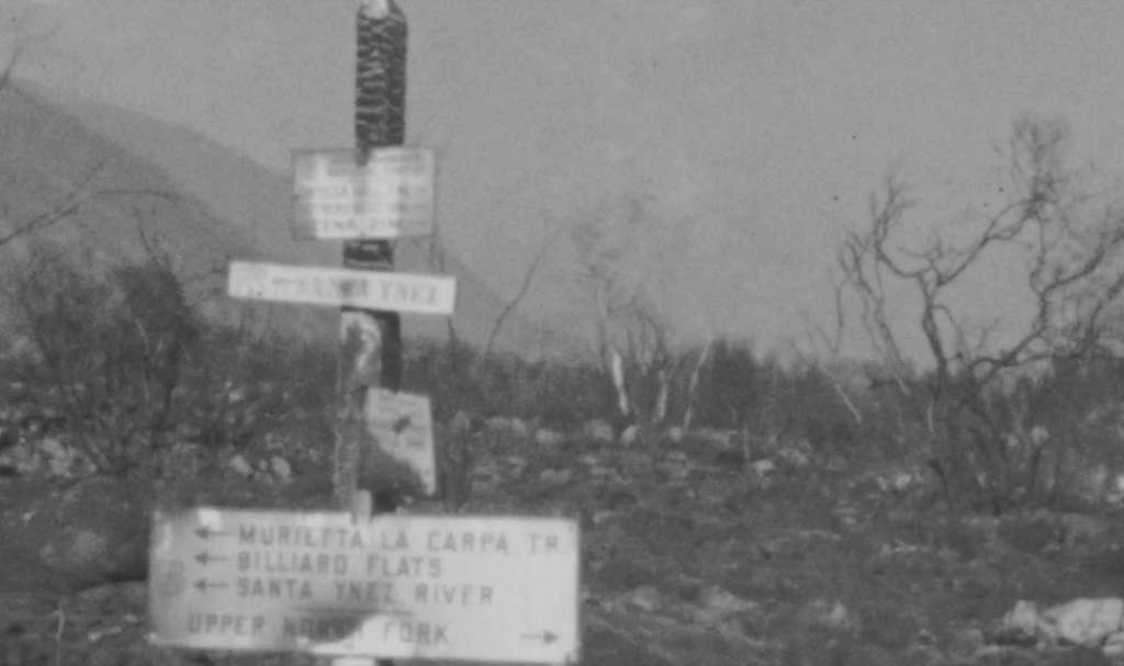
The Origins project identifies this as a critical failure of stewardship. By cross-referencing modern maps with historical USFS records and 19th-century atlases, researchers have uncovered vast discrepancies. In regions like Lake Tahoe and the Los Padres National Forest, trails that had existed for over a century have effectively been "ghosted" from the public record.
Case Studies in Restoration: Ojai and Mount Lola
The work of the Origins project has moved beyond theoretical research into physical restoration, providing a blueprint for how communities might respond to trail erasure.
In Ojai, California, the project focused on the Middle Sespe trail. Following the devastating impacts of the Thomas Fire and a subsequent decade of neglect, eight miles of the trail had completely disappeared into the chaparral. Restoration crews worked to re-open this corridor, which serves as a vital access point to the Los Padres National Forest. The work was not merely about recreation; it was about re-telling the history of the landscape, including Chumash village sites and early Mexican sheep ranching operations that predated the American era.
Further north, on the flanks of Mount Lola near Truckee, California, the project targeted a loop trail originally expanded by the CCC in the 1930s. The trail had been reclaimed by lodgepole pine and erosion. By "re-benching" the tread and clearing miles of brush, crews were able to restore a piece of 20th-century public works history. This restoration serves as a physical reminder of a period when the United States prioritized the creation of shared public commons—a stark contrast to the current era of infrastructure contraction.
Economic and Cultural Implications of Lost Access
The disappearance of trails carries significant economic weight, particularly for rural communities that depend on the "recreation economy." According to the Bureau of Economic Analysis, outdoor recreation accounts for approximately 1.9% to 2.2% of the U.S. Gross Domestic Product, contributing hundreds of billions of dollars to the economy annually.
When wildfire destroys trailheads, campgrounds, and trail networks, the impact on local businesses is immediate and measurable:
- Tourism Decline: Communities surrounded by public lands often see a sharp drop in hotel stays and restaurant revenue when primary recreation corridors are closed or removed from maps.
- Real Estate Values: In regions like Santa Barbara and Mammoth Lakes, proximity to maintained trail networks is a primary driver of property value and community identity.
- Industry Bottom Lines: Outdoor brands—ranging from bicycle manufacturers to technical apparel companies—rely on the existence of trails as the primary "stadium" for their products. Without the infrastructure, the market for high-performance outdoor gear shrinks.
The loss also impacts cultural identity. For many residents of mountain and coastal towns, the "fabric of place" is woven into the ability to move through the landscape. When the government ceases to maintain these lands, residents are often left without the legal or financial support to preserve their own local history and economic stability.
Analysis of the Stewardship Model
The Origins project posits that the future of public lands depends on a shift from "consumption" to "stewardship." For decades, the outdoor industry has marketed the wilderness as a backdrop for personal achievement—fastest known times, epic descents, and scenic photography. However, this model rarely accounts for the fragility of the terrain.
The project’s culmination in various publications—including Rouleur, Freehub, and Adventure Journal—and an upcoming book titled Trail Work (scheduled for release in May 2026 via Heyday), signals a change in the narrative. The argument is that stewardship must become a core component of the outdoor athlete’s identity.
"Stewardship is not optional; it is a responsibility," the project’s findings suggest. This involves a three-pronged approach:
- Adequate Funding: Advocating for legislative solutions that provide the U.S. Forest Service and Bureau of Land Management with the specific funds needed for restoration, rather than just suppression.
- Climate Advocacy: Recognizing that trail preservation is inseparable from climate action. Protecting a trail requires addressing the root causes of the "mega-fires" and floods that destroy them.
- Physical Labor: Re-engaging the public in the "work of hands." The project emphasizes that the act of clearing a corridor or cutting back brush is a way of "writing care back into the land."
Conclusion: Preservation of Meaning
As climate change continues to lengthen fire seasons and intensify weather patterns, the rate of trail loss is expected to accelerate. The work of Dillon Osleger and the Origins project highlights a critical juncture for American public lands. While wildfire may be an inevitable force of nature, the erasure of the stories and access points associated with the land is a choice made through policy and neglect.
By documenting lost trails, restoring physical paths, and highlighting the Indigenous and settler histories embedded in the dirt, the project seeks to ensure that even if a trail is temporarily lost to the flames, it remains in the public consciousness. The preservation of these "ghost lines" is, ultimately, the preservation of the connective tissue between the American people and the history of the land they inhabit. The ongoing effort serves as both a warning of what is being lost and a call to action for a new generation of land managers and outdoor enthusiasts to pick up the tools of restoration.
