

As the calendar turns towards autumn’s end, a palpable excitement is sweeping across the North American ski community. A significant weather system is currently delivering the first measurable snowfall of the 2026-27 season across a broad swath of the western continent, stretching from the high deserts of the Southwest United States to the majestic peaks of the Canadian Rockies. This early taste of winter, arriving weeks ahead of traditional opening dates, is being met with widespread optimism, especially following what many characterized as a challenging previous ski season.
The current meteorological pattern, characterized by a potent cold front interacting with moisture-laden air, is creating ideal conditions for significant accumulation at higher elevations. Forecasters indicate that this system is not merely a fleeting dusting but rather the initial substantial deposit of winter precipitation, setting an encouraging precedent for the months ahead. Resorts are closely monitoring these developments, with some already reporting accumulations that signify the official commencement of their winter preparations.
A Detailed Look at Early Season Snowfall Across the Regions
The impact of this weather system is diverse, with varying levels of snowfall expected across different mountain ranges. However, the overarching theme is one of widespread white conditions, much to the delight of ski enthusiasts and resort operators.
-
Southwest United States: Arizona and New Mexico Lead the Charge
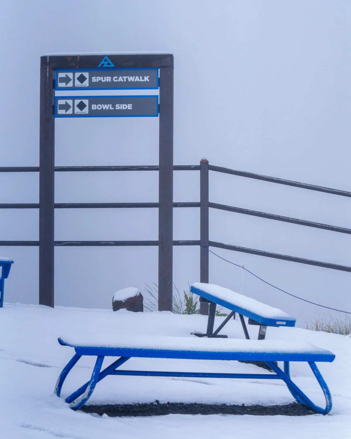
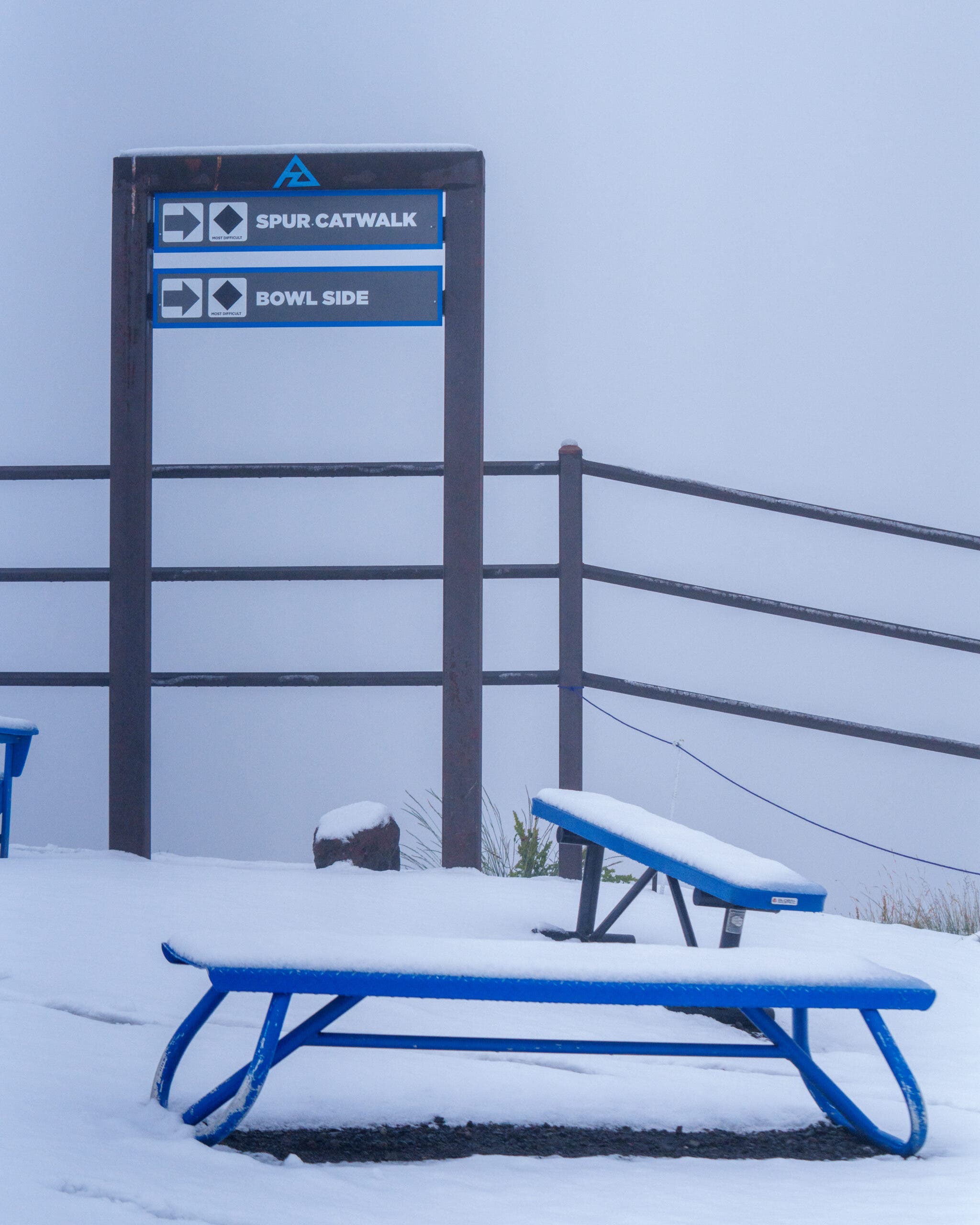
Arizona Snowbowl, nestled in the San Francisco Peaks near Flagstaff, has emerged as a focal point of this early winter activity. On September 29, 2026, the resort officially reported an initial two inches of fresh snow at its summit, with ongoing precipitation suggesting further accumulation. This early snowfall is particularly noteworthy for Arizona, a state not typically associated with early winter conditions, and serves as a significant psychological boost for the regional ski community. Arizona Snowbowl, with a base elevation of approximately 9,200 feet and a summit reaching over 11,500 feet, relies heavily on natural snowfall, and an early start can significantly impact its season length and quality. The sight of snow-covered peaks against the backdrop of still-green valleys is a powerful visual reminder that winter is indeed on its way.Further east, New Mexico’s Taos Ski Valley is also under close observation. This iconic resort, with its summit soaring to 12,481 feet, is considered a "wild card" in this early season forecast. While initial predictions suggested rain for Tuesday, the forecast quickly shifted to include snow showers by Wednesday, accompanied by a sharp drop in temperatures into the 30s. The combination of its extreme elevation, anticipated moisture, and plummeting temperatures makes Taos a prime candidate for measurable accumulation, despite the initial uncertainty. An early snowpack at Taos would be crucial for establishing a solid base on its legendary steep terrain, which often requires significant natural snowfall.
-
Colorado Rockies: A Promising Start for High-Elevation Hubs
The Colorado Rockies, a perennial powerhouse in the North American ski scene, are also poised for a promising start. Several high-elevation resorts within the state’s iconic ranges are expecting substantial snowfall from the same moisture-filled storm system impacting the Southwest. Among the leading contenders are Breckenridge, Loveland, and Powderhorn.Breckenridge, renowned for its high-alpine terrain and peak elevation of 12,998 feet, had already received a dusting earlier in the month, serving as a tantalizing preview. This week’s forecast anticipates up to an additional inch, which, while not a massive dump, contributes to an accumulating base. Loveland Ski Area, often among the first to open in Colorado due to its high elevation (base at 10,800 feet) and advantageous aspect, is also expected to benefit significantly from this system, which could accelerate its pre-season snowmaking efforts if natural snow continues to fall and temperatures remain cold. Powderhorn Mountain Resort, located on the Grand Mesa, is also anticipating fresh snow, crucial for establishing conditions on its varied terrain.
While current resort-level forecasts for Telluride in the high San Juan Mountains do not place it among the biggest snow producers from this specific event, the region’s historically abundant snowfall and extreme elevations (summit at 13,150 feet) warrant close monitoring as the storm progresses. The San Juan Mountains are notorious for capturing significant moisture, and even a slight shift in the storm track could bring considerable snowfall to this picturesque resort.
-
Canadian Rockies: Western Canada Embraces Winter’s Onset
Across the border, the Canadian Rockies are also experiencing the initial embrace of winter. Conditions are shaping up favorably in Western Canada, with several premier resorts bracing for measurable snowfall. Banff Sunshine Village and Nakiska Ski Area, both located in Alberta’s stunning Kananaskis Country, are specifically forecast to receive significant early season snow. Banff Sunshine, with its high elevation and vast terrain, is particularly well-suited to capture early season moisture.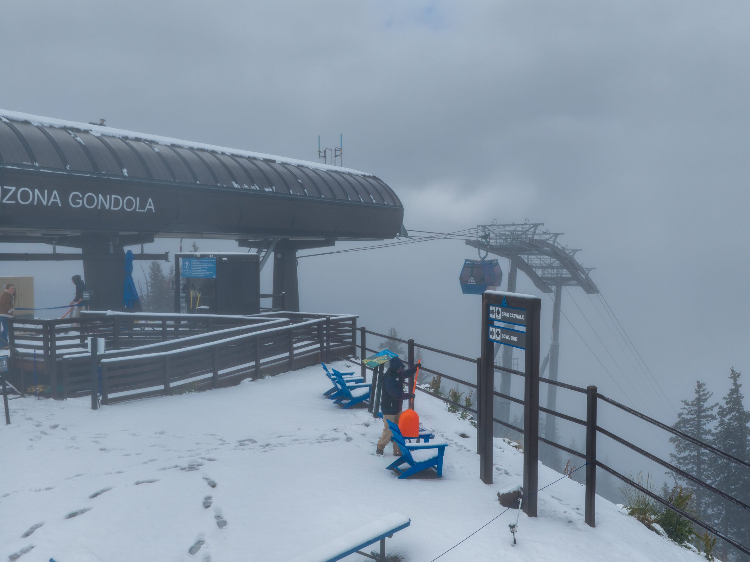
Further west, British Columbia’s world-renowned Whistler Blackcomb, Kicking Horse Mountain Resort, and Lake Louise Ski Resort are also expected to see flakes at their higher elevations. Whistler Blackcomb, with its expansive glaciated terrain and high peaks, often benefits from early season coastal storms. Kicking Horse, known for its steep and deep powder, and Lake Louise, famous for its majestic scenery and extensive terrain, will welcome any early accumulation as they prepare for their respective opening days. This widespread Canadian snowfall bolsters confidence across the entire region’s robust ski tourism sector.
Meteorological Dynamics Behind the Early Snowfall
The current widespread snowfall is primarily attributed to a powerful low-pressure system tracking across the western United States and into Canada, drawing cold air masses down from the Arctic while simultaneously pulling moisture from the Pacific Ocean. This interaction creates an atmospheric setup highly conducive to significant mountain snowfall.
A key factor is the timing of this cold air intrusion. Often, early autumn storms bring precipitation that falls as rain at lower and mid-elevations due to lingering warm temperatures. However, this system features a pronounced drop in the freezing level, allowing snow to fall and accumulate at elevations typically still experiencing milder conditions in late September. The presence of ample atmospheric moisture, especially across the Southwest and parts of Colorado, further enhances the snowfall potential, leading to wetter, denser snow that helps build a solid base.
The jet stream’s configuration is also playing a role, steering these cold and wet systems directly over the western mountain ranges. This specific pattern, while not necessarily indicative of the entire winter’s forecast, is a positive sign for the early season, suggesting that the atmospheric ingredients for winter weather are beginning to align.
Historical Context and the Significance of Early Snow
For many, this early snowfall carries more weight than just a fresh coat of white. The 2025-26 ski season was widely characterized by challenging conditions across many Western resorts, with delayed openings, inconsistent snowfall, and warmer temperatures impacting snow quality and season length. This led to significant frustration among skiers and snowboarders, as well as economic strain for communities heavily reliant on winter tourism.
Against this backdrop, the current early season snowfall is not just a meteorological event; it’s a beacon of hope. Historically, while September and October snowfalls are not unheard of in the highest elevations, widespread, measurable accumulation like that currently observed is a strong indicator of a more robust start to the winter season. Early snow helps to cool the ground, which is crucial for retaining subsequent snowfall and for efficient snowmaking operations once temperatures consistently drop below freezing. A strong natural base also reduces the reliance on artificial snow, conserving water and energy resources for resorts.
Comparing this to historical averages, many resorts typically see their first dustings in October, with significant accumulation usually not occurring until November. The current event, therefore, represents an accelerated start to winter’s embrace, pushing the timeline forward by several weeks in some areas. This advanced timeline allows resorts more time to prepare their infrastructure, assess snow depths, and potentially adjust opening dates if conditions continue to be favorable.
Industry and Community Reactions: A Wave of Optimism
The early arrival of snow has generated a wave of enthusiasm throughout the ski industry and the mountain communities. Resort management teams, who have been meticulously planning for the upcoming season, view this early accumulation as an extremely positive development.
"This early snow is incredibly encouraging," remarked an unofficial spokesperson, echoing sentiments likely shared by numerous resort operators. "It’s not just about the inches on the ground; it’s about cooling the mountain, building excitement, and providing a fantastic psychological boost for our teams and our guests. After last season, every flake counts, and this is a truly promising start."
Local businesses, from gear shops to restaurants and lodging establishments, are also monitoring the forecasts with keen interest. An early, strong start to winter often translates into earlier bookings, increased pre-season sales, and a generally more robust economic outlook for the entire season. The sight of snow-capped peaks inspires confidence and encourages early planning for winter vacations.
Social media platforms are already abuzz with photos and videos from resorts, showcasing the fresh powder. Skiers and snowboarders, often referred to as "snow-starved" after a challenging previous season, are expressing palpable excitement, eagerly anticipating the official opening dates. Online forums and social media groups are filled with discussions about waxing skis, checking gear, and planning first turns. This collective enthusiasm creates a powerful momentum that can significantly impact early season visitation.
Broader Implications and Preparations
Beyond the immediate joy for winter sports enthusiasts, this early snowfall carries broader implications. While the initial accumulations are not yet substantial enough to significantly impact regional water resources, they contribute to the early building of the snowpack, which is a vital source of water for agriculture, municipalities, and ecosystems in the Western states and provinces. Every inch that accumulates now is an investment in future water security.
For resorts, the early cold temperatures accompanying the snow allow for more efficient snowmaking operations. Even if natural snowfall temporarily subsides, the chilled ground and air enable snow guns to operate effectively, quickly building up base depths on critical trails. This dual benefit of natural and artificial snow allows resorts greater flexibility in preparing their terrain for opening day.
Moreover, the early season presents unique challenges and opportunities. While the excitement is high, resort safety teams will emphasize the importance of caution for early-season adventurers. Backcountry conditions can be highly variable and unpredictable with shallow snowpacks, hidden obstacles, and early avalanche hazards. Resorts typically use this pre-opening period to conduct avalanche control, assess terrain, and prepare lifts and other infrastructure for safe public access.
Looking Ahead: The Road to Opening Day
While ski season is still several weeks away for most resorts, this wave of early September snow has undeniably set a positive tone for the 2026-27 winter. The current forecast suggests that while the intensity of this particular storm may diminish, the cooler temperatures are likely to persist, providing opportunities for further natural snowfall and continued snowmaking.
The seven leading contenders for the first significant accumulations over the next seven days, based on current meteorological models and observed conditions, include:
- Arizona Snowbowl (Arizona): Already reporting snow, with more on the way, indicating a strong early start for the Southwest.
- Taos Ski Valley (New Mexico): A "wild card" with high elevation and anticipated cold, making it a prime candidate for measurable accumulation.
- Breckenridge (Colorado): Building on an earlier dusting, expecting more snow to contribute to its base.
- Loveland Ski Area (Colorado): Strategically located for early season snow and cold, poised for accelerated preparations.
- Powderhorn Mountain Resort (Colorado): Anticipating fresh snow on the Grand Mesa, aiding its base development.
- Banff Sunshine Village (Alberta): Receiving measurable snow, enhancing conditions in the Canadian Rockies.
- Nakiska Ski Area (Alberta): Also forecast for significant accumulation, benefiting from the same Canadian weather system.
While an inch or two of snow might not seem monumental in the grand scheme of a full ski season, it represents a crucial first step. It shifts the mindset from anticipation to preparation, from hopeful speculation to tangible evidence of winter’s imminent arrival. As resorts continue their rigorous pre-season work, and enthusiasts begin their traditional "snow dances," this early September snowfall serves as a powerful reminder that the exhilaration of the slopes is drawing ever closer. The 2026-27 ski season has officially announced its presence.
