

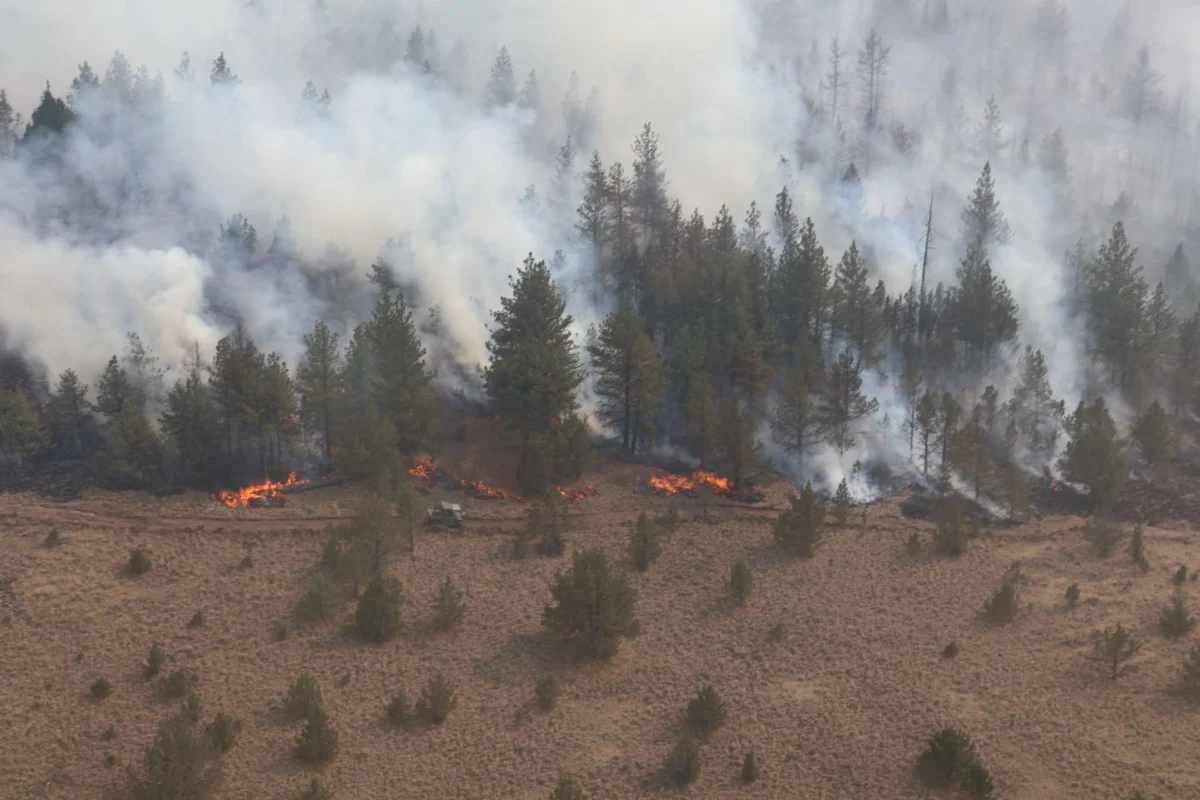
Oregon is in the throes of an unprecedented summer wildfire season, battling a crisis of monumental proportions that has already seen a staggering 76 total wildfires sweep across the state, incinerating well over the 1-million-acre mark. This grim milestone has prompted fire officials to officially categorize the current conflagration as Oregon’s second-worst wildfire season since 1986, evoking memories of past catastrophic events while underscoring the escalating challenges posed by a changing climate. The relentless spread of these blazes, fueled by a confluence of extreme weather conditions and drought, has left a trail of devastation, displacing thousands, threatening rural economies, and casting a pall of smoke across vast swathes of the Pacific Northwest.
The Escalating Scale of Destruction: A Historical Context
The sheer scale of the current wildfire activity is a stark reminder of the increasing vulnerability of Oregon’s landscapes and communities. As of late July, data from the Oregon Department of Emergency Management (OEM) indicates that 63 active blazes continue to burn statewide, many of them exhibiting extreme fire behavior. The rapid accumulation of over one million acres burned places this season firmly in the annals of Oregon’s most destructive fire years. While 1986 holds the unfortunate record for the most acres burned in a single season, the current trajectory suggests a potential to challenge or even surpass that figure if conditions persist. This year’s intensity follows a pattern of increasingly severe fire seasons, including the devastating 2020 Labor Day fires that collectively burned over 1.2 million acres and destroyed thousands of homes, and significant fire activity in 2017. The recurrent nature of these megafires highlights a concerning trend and a pressing need for enhanced preparedness and adaptive management strategies.
Drivers of the Inferno: Climate, Weather, and Fuel Conditions
The primary architects of this summer’s destructive fires are a combination of persistent meteorological phenomena and underlying environmental conditions. High heat, record-setting temperatures, and sustained wind gusts have created an optimal environment for ignition and rapid fire propagation. Compounding these factors, frequent dry lightning strikes have acted as a relentless ignition source, often sparking multiple fires in remote, difficult-to-access areas simultaneously.
Crucially, Oregon has been experiencing severe to extreme drought conditions across much of the state for several consecutive years. This prolonged aridity has transformed vast expanses of forests, grasslands, and rangelands into tinderboxes. Vegetation, stressed by lack of moisture, dries out prematurely, creating an abundance of highly flammable fuels. Even seemingly minor ignitions, whether from lightning or human activity, can quickly escalate into uncontrollable infernos under these volatile conditions. Experts from the Oregon Department of Forestry (ODF) and federal agencies have repeatedly warned that decades of fire suppression, while protecting communities in the short term, have also led to an unnatural accumulation of fuel loads in many forested areas, making them ripe for large-scale, high-intensity fires when extreme weather hits. This interplay of climate change-driven heat and drought, coupled with historical land management practices, has set the stage for the monumental crisis currently unfolding.
The Megafires: A Detailed Breakdown of Key Incidents
While dozens of fires contribute to the overall acreage, a handful of massive fire complexes account for the vast majority of the destruction across eastern and central Oregon. These behemoths are not merely burning; they are actively reshaping ecosystems, consuming critical wildlife habitats, and posing immense challenges to firefighting efforts.
- Row Creek Complex: This fire complex currently stands as the largest active blaze, having charred an astonishing 295,000 acres. Located in a remote, rugged area, its expansion has been particularly aggressive, making containment a formidable task. Firefighters have achieved only 42% containment, signaling the immense challenge ahead and the potential for further growth. The Row Creek Complex exemplifies the difficulties in battling fires in complex terrain, often requiring extensive air support and highly skilled ground crews working in arduous conditions.
- Big Grass Fire: Hot on the heels of the Row Creek Complex, the Big Grass Fire has consumed a massive 292,000 acres of rangeland. This fire, characterized by its rapid movement across open country, poses a significant threat to livestock operations and critical grazing areas that define the agricultural backbone of central Oregon. Its spread is often dictated by wind patterns, allowing it to traverse vast distances quickly and unpredictably.
- Hay Creek Complex: While substantial, having consumed 193,000 acres, the Hay Creek Complex offers a glimmer of progress with a commendable 90% containment. This higher containment figure suggests that incident management teams have been successful in establishing and holding fire lines, a testament to the concentrated efforts of firefighters. However, even at 90% containment, the remaining uncontained sections require constant vigilance to prevent flare-ups or breaches, especially under shifting weather conditions.
- Coleman Fire: Rounding out the quartet of the largest blazes, the Coleman Fire has scorched another 180,000 acres. This fire has been particularly concerning due to its direct threats to livestock, open pasture, and potentially isolated rural homesteads. The economic impact on individual ranchers and the broader agricultural community from fires like Coleman is immediate and severe, affecting not only current grazing lands but also long-term forage availability.
These megafires are not merely burning trees; they are fundamentally altering the high-desert terrain, vaporizing crucial wildlife habitats, and consuming vast areas of open country that serve as vital ecological corridors. The sheer size and intensity of these fires leave behind landscapes dramatically transformed, with long-term ecological recovery often spanning decades.
The Devastating Human and Agricultural Impact

The human and agricultural toll of these blazes is both immediate and profoundly severe. As of July 28, reporting from OPB News indicated that at least 6,000 people were placed under active evacuation orders, a testament to the direct threat posed to residential areas. Families across numerous rural counties have been forced to leave their homes with little to no notice, abandoning possessions and livelihoods to escape the encroaching flames. The emotional trauma and uncertainty faced by these displaced residents are immense, with many wondering if their homes and communities will still be standing upon their return.
Eastern and central Oregon farmers and ranchers are bearing an incredible hit, facing losses that could take years, if not decades, to recover from. The rapid movement of these wildfires often makes it exceedingly difficult for farmers to safely evacuate cattle and other livestock quickly. Thousands of animals have been caught in the path of the flames, resulting in direct losses or severe injuries. Beyond the immediate threat to livestock, the fires have wiped out immense tracts of pasturelands, destroying crucial forage for grazing animals. Miles of fencing, essential for livestock management, have been incinerated, requiring costly and time-consuming reconstruction. Agricultural equipment, from tractors to irrigation systems, has also been consumed or severely damaged, representing significant capital losses for these family-run operations. The disruption to the agricultural supply chain, from feed production to market access, will have ripple effects across the regional economy.
Beyond the immediate threat of the flames, smoke has blanketed regional valleys, creating a pervasive public health hazard. Air Quality Index (AQI) levels have surged as high as 169 in some areas. An AQI of 169 falls into the "Unhealthy" category, meaning that sensitive groups, including children, the elderly, and individuals with heart or lung disease, are likely to experience health effects. Even healthy individuals may experience symptoms such as coughing, shortness of breath, or irritation of the eyes, nose, and throat. For outdoor workers, especially those in agriculture or firefighting, these conditions pose a significant occupational health risk, forcing adjustments to work schedules and the use of personal protective equipment.
Official Responses and Coordinated Efforts
The response to Oregon’s wildfire crisis has been a monumental undertaking, involving a vast array of local, state, and federal agencies. The Oregon Department of Forestry (ODF) and the Oregon Department of Emergency Management (OEM) are at the forefront of state-level coordination, deploying resources, managing incident command structures, and disseminating crucial public safety information. They are supported by federal partners such as the U.S. Forest Service (USFS) and the Bureau of Land Management (BLM), which manage vast tracts of federal lands where many of these fires are burning.
Governor Tina Kotek’s office has been actively engaged, declaring states of emergency in affected counties to facilitate resource deployment and provide aid. In a recent statement, the Governor emphasized the severity of the situation, acknowledging the "immense strain on our communities and our firefighters" and reiterating the state’s commitment to "deploying every available resource to protect lives, homes, and critical infrastructure." The coordination involves thousands of firefighters, dozens of aircraft including helicopters and air tankers, and specialized incident management teams working around the clock. Challenges include the vast geographical spread of the fires, the complexity of the terrain, and the sheer number of simultaneous incidents stretching resources thin. Mutual aid agreements with neighboring states have been activated, bringing in additional personnel and equipment to bolster the front lines.
Protecting Our Backcountry and Supporting Communities: Long-Term Implications
The wildfires’ impact extends far beyond the immediate burn scar. Wildfires destroy crucial trail infrastructure, rendering popular recreational areas inaccessible for extended periods. Alpine vegetation, critical for ecosystem health and water retention, is often wiped out, leading to increased risks of post-fire flooding and erosion. Furthermore, these fires displace local communities that make these mountain and rural towns special, threatening their economic viability, particularly those reliant on tourism and outdoor recreation. The recovery for both local farming families and public land managers will be a protracted process, requiring significant investment and sustained effort over many years.
Ecologically, the long-term implications are profound. Changes in soil composition, alterations to water cycles, and the loss of biodiversity are significant concerns. While some ecosystems are fire-adapted, the intensity and frequency of these megafires can overwhelm natural regenerative capacities, leading to permanent shifts in landscape composition. Economically, beyond agriculture, the timber industry faces losses, and the tourism sector, a vital component of many rural economies, will feel the effects of closures and negative perceptions of air quality.
Looking ahead, the current crisis underscores the urgent need for enhanced fire prevention, mitigation, and adaptation strategies. This includes investing in forest health initiatives, such as thinning and prescribed burns in appropriate areas, to reduce fuel loads. It also means supporting communities in developing "fire-wise" landscaping and building practices to increase resilience against future fires. For public land managers, the focus will shift to rehabilitation efforts, including replanting, erosion control, and restoring wildlife habitats, a task that will span generations.
While emergency crews work tirelessly around the clock to build and hold containment lines, the broader community has a vital role to play. Respecting all temporary trail and area closures is paramount, as these are implemented for public safety and to allow emergency personnel to operate without interference. Strictly adhering to campfire bans and other fire restrictions, which are often implemented under extreme conditions, is non-negotiable. Checking local fire maps and official incident websites for the latest updates is crucial for anyone planning to recreate or travel in fire-prone areas. Every individual action contributes to reducing the risk of new ignitions and supporting the monumental efforts underway to bring these devastating fires under control and begin the long journey toward recovery.
