

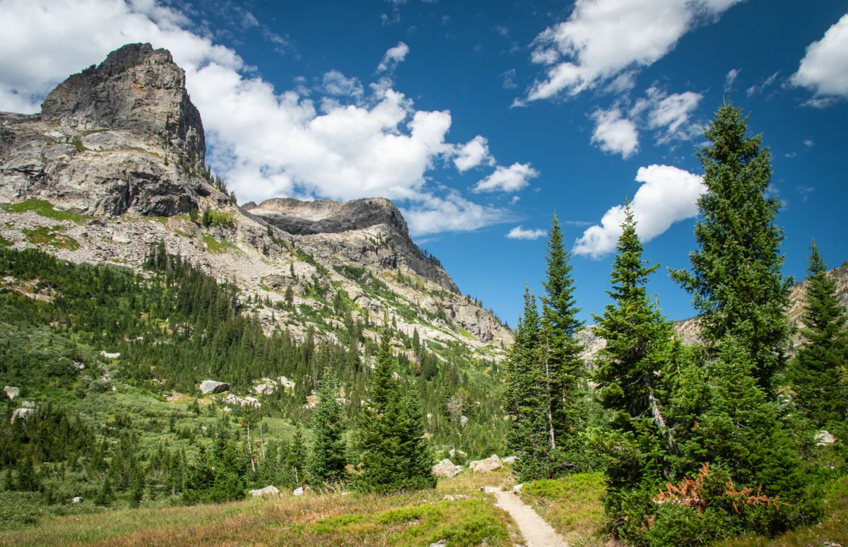
Teton County Search & Rescue (TCSAR) volunteers located the body of a 28-year-old Australian thru-hiker on Wednesday morning, July 29, on the western slope of the Tetons, nearly a week after he was reported missing. The young backpacker, who had been attempting a southbound thru-hike of the challenging 3,028-mile Continental Divide Trail (CDT), was discovered below a ridgeline south of North Wigwam Peak. Evidence gathered at the scene suggests a fatal fall from an exposed section of the divide between Grand Teton National Park and the surrounding wilderness area.
The Allure and Peril of the Continental Divide Trail
The Continental Divide Trail is one of North America’s most formidable long-distance hiking routes, forming the backbone of the "Triple Crown" of hiking alongside the Appalachian Trail and the Pacific Crest Trail. Spanning approximately 3,100 miles (3,028 miles as cited by the hiker), it traverses five U.S. states—Montana, Idaho, Wyoming, Colorado, and New Mexico—and connects with portions in Canada and Mexico. Unlike its more established counterparts, much of the CDT is less defined, often relying on cairns, faint paths, and even cross-country navigation, demanding a higher degree of wilderness skills, self-reliance, and physical endurance. Hikers typically begin in late spring or early summer, aiming to complete the journey before the onset of harsh winter conditions in the northern Rockies or desert heat in the south. The trail gains and loses over 200,000 feet in elevation, crossing diverse ecosystems from high-alpine tundra to arid deserts, presenting challenges that range from extreme weather shifts, difficult river crossings, and wildlife encounters to prolonged periods of isolation. The sheer scale and ruggedness of the CDT attract a particular breed of adventurer, drawn by the promise of unparalleled natural beauty and a profound test of human spirit.
A Journey Interrupted: The Hiker’s Last Known Movements
The 28-year-old Australian, whose identity has not yet been publicly released, began his ambitious southbound thru-hike at the Canadian border earlier this summer. Like many modern long-distance hikers, he utilized a Garmin satellite messenger device to track his progress and maintain regular communication with family members in Australia. These devices, which offer two-way satellite communication and GPS tracking, have become essential safety tools for adventurers venturing into areas without cell service, providing a crucial link to the outside world.
His routine check-ins, which had provided reassurance to his family across continents, ceased abruptly. The last recorded update from the hiker’s satellite messenger came on July 19. At that time, he was traveling near the iconic Old Faithful geyser in Yellowstone National Park, approximately 50 miles north of the Tetons. During this last communication, he outlined his intended route for the coming days and weeks, which included traversing the challenging Tetons, followed by the rugged Gros Ventre Wilderness, the majestic Wind River Range, and ultimately the vast, arid Divide Basin in Wyoming. This planned itinerary underscored his commitment to tackling some of the most remote and demanding sections of the CDT.
Mounting Concern and the Initiation of a Search
When the routine satellite updates stopped, a palpable sense of concern began to grow among the hiker’s family. Days passed without a new message or location ping, a significant deviation from his established communication pattern. Recognizing the gravity of the situation, especially given the remote and dangerous terrain he was expected to be navigating, his family initiated contact with authorities. The formal missing person report was filed, triggering a multi-agency response centered on the last known coordinates provided by his Garmin device.
Law enforcement and park officials began to coordinate with Teton County Search & Rescue, a highly specialized volunteer organization renowned for its expertise in high-alpine rescues within the formidable Teton Range. The window for a successful search operation narrows with each passing day in such unforgiving environments, making swift and decisive action paramount. Initial efforts involved reviewing the hiker’s last known location, his planned route, and assessing potential hazards in the area. The sheer size of the search area, coupled with the rugged, often trail-less terrain of the Tetons, presented significant logistical challenges for rescue teams.
Teton County Search & Rescue Mobilizes
Given the critical nature of the situation and the challenging mountainous environment, Teton County Search & Rescue mobilized its resources. On the morning of Wednesday, July 29, at first light, a specialized helicopter short-haul team was deployed. This elite team, comprising highly trained rescuers and pilots, is equipped to conduct aerial reconnaissance and extraction operations in extreme terrain, often employing techniques like short-haul where rescuers are suspended beneath the helicopter to access difficult-to-reach locations.
The aerial search focused intensively on the vicinity of the hiker’s last reported position and his projected route through the Teton wilderness. Rescuers meticulously scanned the vast landscape, leveraging their knowledge of the local terrain and experience in locating missing individuals. The effectiveness of such operations hinges on favorable weather conditions and the sharp eyes of the crew members, who look for any anomalies in the natural environment that might indicate human presence or distress.
The Discovery: A Tragic Outcome in Rugged Terrain

The persistent efforts of the TCSAR helicopter short-haul team yielded a somber discovery. From the air, rescuers quickly spotted a bright orange backpack, a stark contrast against the natural hues of the mountainside. This sighting proved crucial, leading the team to narrow their focus. Following the visual cue, the subject was ultimately located below a ridgeline situated south of North Wigwam Peak. The location itself speaks volumes about the extreme nature of the terrain the hiker was attempting to navigate.
Initial assessment at the scene indicated that the hiker had suffered a fatal fall. Evidence collected strongly pointed to a plunge from an exposed divide, a narrow and treacherous ridge that separates the Grand Teton National Park from the adjacent wilderness area. These high-altitude divides are characterized by sheer drop-offs, loose scree, and unpredictable footing, often exacerbated by rapidly changing weather conditions. The precise circumstances leading to the fall remain under investigation, but the inherent dangers of such an exposed traverse are well-documented. Following the grim discovery, flight crews undertook the delicate and hazardous operation of recovering the hiker’s body. He was then transported to TCSAR headquarters in Jackson, where the case was formally handed over to the Teton County Coroner for official identification and determination of the exact cause of death.
The Perilous Teton Section of the CDT
The section of the Continental Divide Trail that traverses the Teton Range, particularly the alternate route that leads over peaks like North Wigwam, is widely regarded as one of the most technical and exposed segments of the entire 3,000-plus-mile trail. While the main CDT route generally skirts the Teton wilderness to the east, many thru-hikers opt for more scenic and challenging high-altitude alternates that venture directly into the heart of the range. These routes, though offering breathtaking vistas, demand advanced mountaineering skills, experience with route-finding in unmarked terrain, and a keen awareness of environmental hazards.
The high-altitude CDT alternate route over the Wigwams, for instance, is notorious for its sharp, exposed ridges. These sections often involve significant scrambling over rock and talus, with steep drop-offs on either side, requiring unwavering focus and precise foot placement. Weather in the Tetons is famously unpredictable; clear skies can give way to violent thunderstorms, lightning, hail, and even snow, even in the height of summer. These sudden meteorological shifts can transform an already challenging traverse into a life-threatening ordeal, reducing visibility, making rock surfaces slick, and inducing hypothermia. The inherent risks are compounded by the remoteness of the area, where assistance can be hours, if not days, away, even with satellite communication devices.
Insights into Backcountry Safety and Risk Mitigation
This tragic incident serves as a poignant reminder of the inherent risks associated with long-distance wilderness travel, even for experienced hikers equipped with modern safety tools. While satellite messengers like the Garmin device used by the hiker are invaluable for communication and emergency alerts, they do not negate the fundamental need for thorough preparation and sound decision-making in the backcountry.
Experts in wilderness safety consistently emphasize several key protocols:
- Detailed Trip Planning: Beyond mapping a route, this includes researching terrain, understanding elevation profiles, identifying potential escape routes, and knowing water sources and resupply points.
- Weather Awareness: Constantly monitoring forecasts and being prepared to alter plans or seek shelter if conditions deteriorate. Mountain weather can change rapidly and drastically.
- Appropriate Gear: Carrying essential gear for all foreseeable conditions, including layers for warmth, rain protection, adequate navigation tools (map, compass, GPS), first-aid supplies, and emergency shelter.
- Communicating Itinerary: Sharing a detailed itinerary with a trusted contact who knows when to expect check-ins and what action to take if communication ceases.
- Understanding Personal Limits: Recognizing one’s own skill level, physical condition, and comfort zone, and choosing routes accordingly. The allure of a challenging alternate route should always be weighed against the potential for elevated risk.
- Situational Awareness: Remaining vigilant about surroundings, recognizing hazards, and making conservative decisions, especially in exposed or technically demanding terrain. The "local perspective" from Teton Gravity Research, based at the foot of these peaks, underscores that even seasoned locals hold immense respect for how quickly conditions and terrain can turn dangerous.
Official Responses and Community Reflections
In the wake of the recovery, officials from Teton County Search & Rescue expressed their deepest condolences to the family and friends of the deceased hiker. While specific statements are often reserved during ongoing investigations, SAR teams frequently use such incidents to reiterate critical safety messages to the public, underscoring the unpredictable nature of wilderness environments and the need for preparedness. The Teton County Coroner’s office will conduct a full investigation to officially determine the cause and manner of death, a standard procedure in such cases.
The news of a thru-hiker’s death resonates deeply within the tight-knit long-distance hiking community. These individuals often share a unique bond forged through shared experiences on the trail. The incident serves as a sobering reminder of the sacrifices and risks inherent in pursuing such ambitious endeavors. Discussions on online forums and social media channels dedicated to thru-hiking often turn to reflections on safety, the importance of respecting the wilderness, and shared grief for a fellow adventurer lost to the mountains. For local communities like Jackson, Wyoming, where outdoor pursuits are central to the culture, such tragedies hit close to home, reinforcing the daily reality of living amidst formidable and beautiful, yet unforgiving, landscapes.
The Broader Context of Long-Distance Hiking
The popularity of long-distance hiking has seen a significant surge in recent decades, driven by increasing media coverage, social media sharing, and a growing desire for immersive outdoor experiences. Trails like the CDT attract thousands of hopeful thru-hikers annually, a number that continues to grow. This rise in popularity, while positive for promoting outdoor recreation, also brings challenges, including increased demand on trail resources and, unfortunately, a potential increase in incidents requiring search and rescue.
The story of this Australian thru-hiker is a stark illustration of the fine line between adventure and peril. It highlights the critical balance between embracing the wild and respecting its power. While technology like satellite messengers has undoubtedly enhanced safety, the ultimate responsibility for risk management lies with the individual adventurer. The mountains, particularly those as grand and rugged as the Tetons, demand humility, meticulous preparation, and a profound respect for their inherent dangers. This tragedy will undoubtedly spark further conversations within the outdoor community about how to best educate, equip, and prepare those who seek to answer the call of the wild.
