

Today, the sea surface temperature near Palmyra Atoll—a tiny stroke of land in the middle of the Pacific Ocean, thousands of miles from the nearest ski resort—is approximately one degree warmer than historical averages. While a single degree of variance might be imperceptible to a passenger on a boat deck, it represents a thermal shift significant enough to reroute the global jet stream. In the complex machinery of Earth’s climate, this localized warming serves as a leading indicator for winter precipitation patterns across the Northern Hemisphere, determining where snow will fall and where droughts will persist.
The physics behind this connection is fundamental yet profound. Warm water heats the atmosphere immediately above it, which in turn lowers the surface pressure over that specific stretch of the ocean. Under normal conditions, the trade winds blow from east to west across the Pacific, pinning warm water near Indonesia and keeping eastern outposts like Palmyra comparatively cool. However, when these winds weaken, a self-reinforcing feedback loop is triggered. A warm patch emerges, the pressure balance shifts, and the trade winds weaken further. This allows a massive pool of warm water to slide eastward, reinforcing the process and altering the locations where major storms originate. This shift in the jet stream eventually reshapes the storm tracks that barrel into the Rocky Mountains and the American West months later.
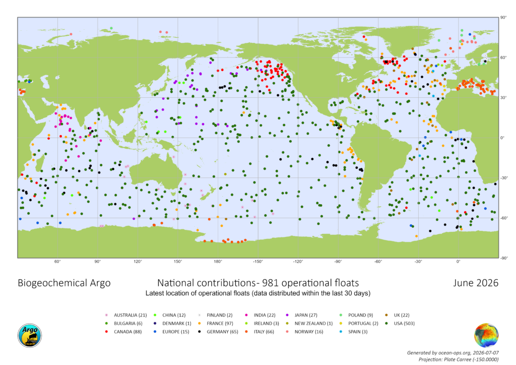
The precision with which scientists can now track these shifts is not the result of manual thermometry or manned expeditions. Instead, it is the product of the Argo program, a global fleet of approximately 4,000 autonomous robotic floats that have been profiling the ocean in real time since the early 2000s. These robots operate at depths of over a mile, surfacing every 10 days to beam their findings via satellite to global data centers. Despite its status as the backbone of modern meteorology and oceanography, the Argo program currently faces a critical threat of defunding, a situation exacerbated by shifting federal priorities and administrative budget cuts.
The Mechanics and Evolution of the Argo Fleet
The Argo program, named after the mythical Greek ship Argo used by Jason and the Argonauts, was conceptualized in the late 1990s and officially launched in 1999. Its primary objective was to create a "global array of temperature/salinity profiling floats" to observe the ocean’s role in the climate system. For over two decades, the program has revolutionized marine science by providing a consistent, 24/7 "snapshot" of the world’s oceans, which cover 71 percent of the Earth’s surface.
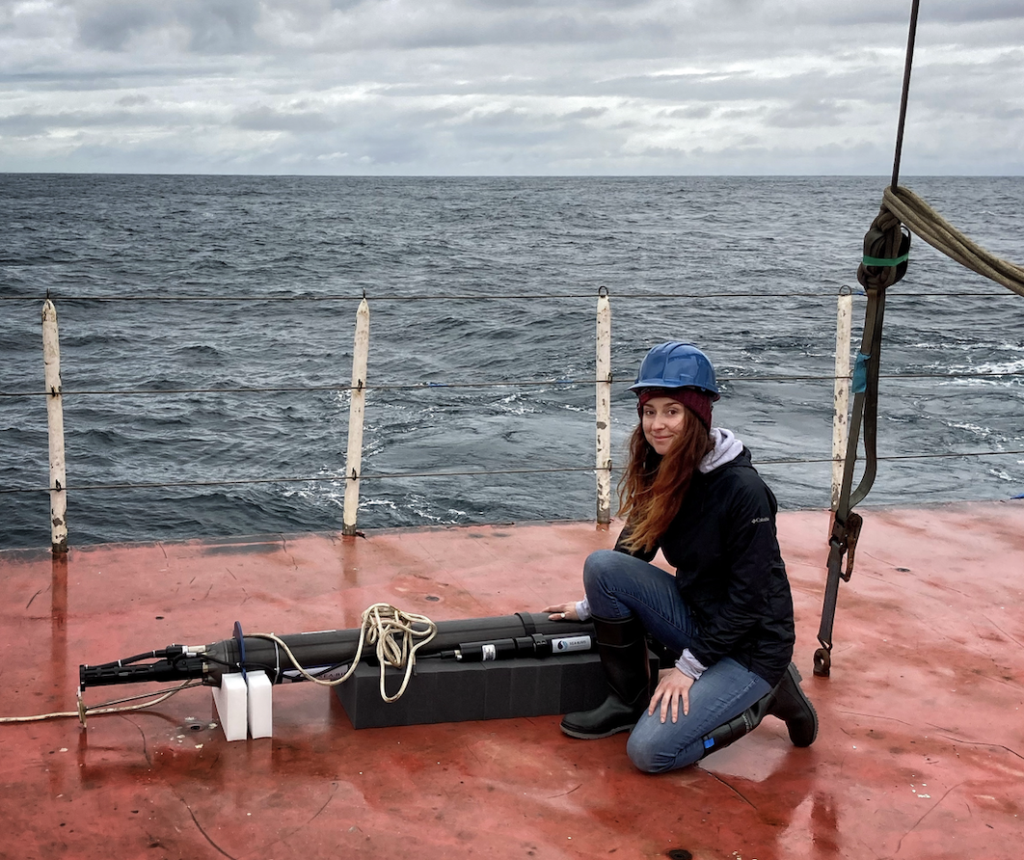
Each Argo float is a highly sophisticated piece of engineering designed to withstand the immense pressures of the deep sea. The standard mission of a float begins with its deployment from a ship or aircraft. Once in the water, the float sinks to a "drift depth" of approximately 1,000 meters, where it remains for several days, moving with the deep-sea currents. It then descends further to 2,000 meters before beginning a slow ascent to the surface. During this ascent, its sensors continuously record temperature, salinity, and pressure. Upon reaching the surface, the float uses a satellite link (historically the Argos system, and more recently Iridium) to transmit the collected profile data and its GPS location.
In recent years, the program has expanded its technological reach. The introduction of Biogeochemical (BGC) Argo floats has added sensors to measure oxygen levels, pH, nitrate, and chlorophyll. These metrics are vital for understanding ocean acidification and the health of marine ecosystems. Additionally, "Deep Argo" floats have been developed to dive to depths of nearly four miles (6,000 meters), allowing scientists to monitor the abyssal plains—areas of the ocean that remain among the least understood regions on the planet.
A Crucial Component of Global Weather Forecasting
The data provided by Argo is not merely of academic interest; it is the foundational layer for nearly every weather forecast relied upon by the public, the military, and the private sector. "The ocean stores the bulk of heat and moisture that drives our weather," explains Dr. Shawnee Traylor, a chemical oceanographer and carbon cycle scientist associated with the POW Science Alliance. "Satellites capture the surface, but forecasters need that subsurface picture to understand what’s brewing below and when we’ll see it in the weather."
For the maritime industry, Argo data is essential for safe navigation and efficient routing. For fisheries, the data helps predict changes in water temperature and nutrient levels that dictate fish migrations and population health. For coastal communities, the program serves as an early warning system for sea-level rise. As the ocean absorbs heat, the water expands—a process known as thermal expansion. This phenomenon accounts for approximately one-third of the current global sea-level rise. Argo’s ability to measure the rate of warming at various depths allows for more accurate modeling of how quickly coastal inundation will occur.
Furthermore, the heat-absorption capacity of the ocean is staggering. Research facilitated by Argo data indicates that the world’s oceans absorb approximately 90 percent of the excess heat generated by greenhouse gas emissions. Dr. Traylor notes that this is equivalent to "exploding 12 atomic bombs in the ocean each second." Without the continuous monitoring provided by Argo, the international community would be largely blind to the true scale of planetary warming.
The Funding Crisis and Administrative Hurdles
Despite the program’s undeniable utility, its future is increasingly uncertain. The United States has historically been the primary contributor to the Argo network, maintaining over half of the global fleet. However, funding for the program is decentralized, relying on a patchwork of grants from the National Oceanic and Atmospheric Administration (NOAA) and the National Science Foundation (NSF).
Currently, a five-year NSF grant that previously funded the deployment of 500 new BGC-Argo floats has expired. A proposal for a successor grant to maintain and replenish the fleet has been caught in an administrative vacuum for over 20 months. Typically, such proposals receive a response within six months. This silence from the NSF, coupled with broader scientific funding cuts under the current administration, has placed the program in a precarious position.
Reports indicate that grants for oceanography have been slashed by nearly 50 percent since last year. For the BGC-Argo initiative specifically, there is currently no capital allocated to build new U.S. floats for the upcoming year. "We haven’t been told no yet, but we’re running out of time," Dr. Traylor warns. "At a certain point, we start losing jobs and decades of critical technical expertise. Data quality will start degrading, and within a couple of years, that’ll show up downstream as less reliable forecasts for extreme weather events."
Economic and Security Implications of Data Loss
The potential degradation of the Argo network poses significant risks to national security and economic stability. Reliable weather forecasting is a multi-billion-dollar industry, influencing everything from agricultural yields to the energy market. Sparser data leads to less accurate models, which in turn reduces the lead time for preparing for extreme weather events like hurricanes and blizzards.
In the context of national defense, the U.S. Navy relies on precise oceanographic data for submarine operations and acoustic modeling. Changes in salinity and temperature affect how sound travels underwater, making Argo data a strategic asset for underwater surveillance and tactical planning.
From an environmental standpoint, the loss of Argo data would cripple the ability to monitor the ocean’s role as a carbon sink. The ocean currently absorbs roughly 30 percent of human-made CO2 emissions. Understanding the limits of this absorption capacity is critical for international climate policy and the development of carbon sequestration technologies.
Precedents for Preservation: The Role of Congress
The current crisis facing Argo is not without precedent. Another major ocean research initiative, the Ocean Observatories Initiative (OOI), recently faced a similar threat of dismantling and defunding. The OOI is a network of permanent sensor arrays located in key coastal and open-ocean locations.
In that instance, bipartisan support in the U.S. Senate proved to be the deciding factor in the program’s survival. In June, Senators Jeff Merkley (D-OR) and Lisa Murkowski (R-AK) spearheaded legislation that successfully blocked the defunding of the OOI. A letter signed by 11 senators to the NSF emphasized that the system delivers "crucial information about our ocean patterns and weather, reaching and touching all Americans." The senators argued that dismantling such a vital network would jeopardize decades of research and compromise public safety.
Proponents of the Argo program are now calling for a similar intervention. While the OOI focuses on high-resolution data from specific locations, Argo provides the global breadth necessary for planetary-scale modeling. Advocates argue that without Congressional action to secure long-term, centralized funding, the U.S. risks ceding its leadership in marine science and losing a tool that is essential for modern life.
Conclusion: A Narrow Window for Action
The Argo program represents one of the most successful international scientific collaborations in history, involving over 30 countries and providing free, open-access data to the global public. However, the "silent" nature of the robots—floating thousands of miles from shore and operating beneath the waves—often keeps the program out of the public eye.
As the existing fleet of floats reaches the end of its operational lifespan (typically four to five years), the lack of new deployments will lead to "holes" in the global data map. For the skiers waiting for snow in the Rockies, the coastal residents watching the tide lines, and the farmers planning their spring crops, the stakes are remarkably high.
"Public pressure on governments might help," Dr. Traylor suggests. "But right now, we need to raise awareness. Even in marine science, many don’t know about the looming threat to one of the most successful research programs in the world."
The coming months will be decisive. If the funding gap is not bridged, the global community may find itself navigating a rapidly changing climate with a significantly diminished capacity to see what is coming. The "12 atomic bombs" of heat continue to enter the ocean every second; the question remains whether we will continue to have the eyes in the water to track them.
